
SCROLL TO EXPLORE
Construction Leaders Backed by Maply


Smart data that
moves your site forward.
Visualize, analyze and control every detail of your project with precision. Maply delivers features that raise the bar for site and engineering management.
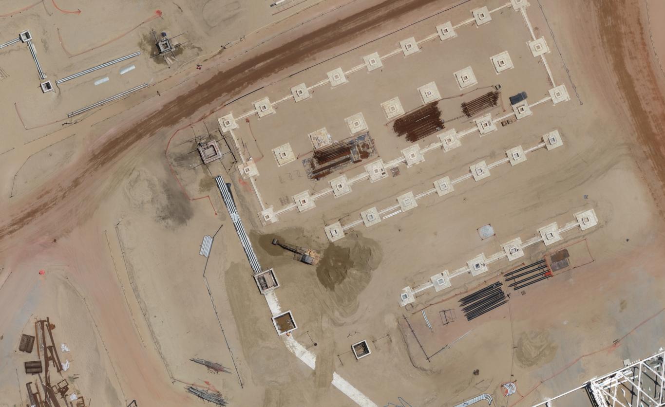
Track earthworks progress with ease.
Manage earthworks with drone-generated surfaces via Maply, getting accurate cut-and-fill measurements, volume calculations and detailed tracking.

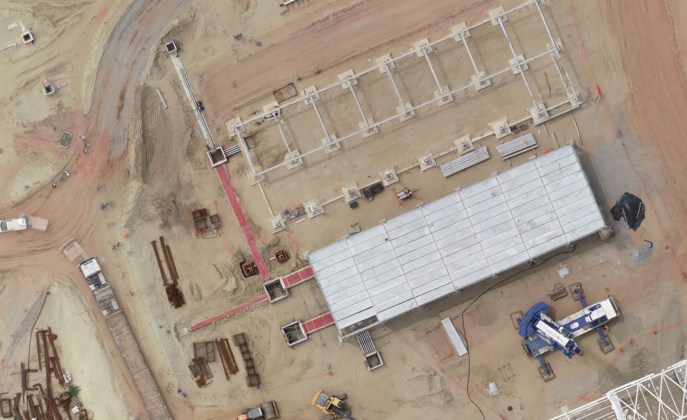
Continuous site monitoring, effortless
Monitor your sites with recurring surveys, tracking progress in real time. Compare data across dates to spot trends and optimize processes.
Flight-by-flight comparison
Compare maps or photos from different dates to spot site changes. Ideal for validating completed stages and verifying compliance with the plan.
Volumetric control of aggregate stockpiles
Manage stockpiles of sand, gravel and crushed stone with precise volumetric measurements. Use aerial mapping to calculate volumes, track variations and optimize material use on-site.
CAD overlay
Overlay CAD drawings on top of real site maps to verify alignment between design and execution with precision. Spot deviations quickly and ensure structural and architectural elements match the plan.
BIM, CAD and topography overlays
Import and overlay CAD/BIM drawings to align designs with real data. Spot deviations between planned and built quickly and accurately.
Run measurements with ease and precision
Team communication and collaboration
Streamline team communication with annotations directly on the maps — fast decisions, full alignment and a single source of truth accessible to everyone.

Export detailed reports
Build comprehensive reports with annotations, measurements and comparisons, exportable for stakeholders. Complete documentation of site progress.
Integrate your data with CAD and BIM platforms with ease
Transform your engineering projects with seamless Maply integrations. Export orthophotos, point clouds and surface models to CAD and BIM software.

AutoCAD
Export mapping data directly to AutoCAD for precise engineering projects.

Revit
Integrate point clouds and surface models with Revit for advanced BIM modeling.

Civil 3D
Export high-precision terrain data to Civil 3D for infrastructure projects.

Navisworks
Combine your mapping data with 3D models in Navisworks for project coordination.

InfraWorks
Integrate your geospatial data with InfraWorks for visualization and urban planning.
Didn't find the integration you need? Talk to our team
Do campo para a análise em
três passos simples
Nossa plataforma simplifica o processo de captura, processamento e análise de dados geoespaciais
Capture imagery in the field
Plan and run autonomous flights. Set altitude and overlap parameters to capture high-quality imagery.
Cloud processing
Automatic upload and intelligent cloud processing. We turn your imagery into maps and 3D models.
Analysis and collaboration
Visualize results, analyze data and collaborate with your team in real time on our platform.
Palavras de parceiros
Gualter
Anderson
“Navigating Maply’s platform is very fluid and gives us a broad view of the project, helping us with planning and action plans across construction sites.”

Pedro Rodrigues
Civil Planning
Andrade Gutierrez
“Navigating Maply’s platform is very fluid and gives us a broad view of the project, helping us with planning and action plans across construction sites.”

Pedro Rodrigues
Civil Planning
Andrade Gutierrez